The solace of deep Anthropocene time

Megaliths are often utilized as war memorials, usually with the memorial taking the form of ‘replica’ standing stones, precise stone settings or highly stylized megalithic tombs. These very often occur in urban contexts, and fall into my category of urban prehistoric sites that evoke ancient forms of monument rather than being genuinely ancient in themselves.

Howard Williams has explored this phenomenon in much more depth than I, for instance in relation to the National Memorial Arboretum, Staffordshire, in a paper in the International Journal of Heritage Studies (2014). This remarkable landscape of remembrance consists of hundreds of memorial gardens, memorials and monuments, and 30,000 plus trees (many dedicated to individuals and organisations), numbers that are being added to constantly giving the place a sense of dynamism as well as stoicism. Memorials include concoctions of stones from various parts of the UK and France, mnemonics for represented organisations and memorialized events; these include ‘a cairn commemorating the Loch Class Frigates … incorporating stones from each of the Scottish lochs after which the Frigates were named’ (pg 10). Williams calls the Arboretum a ‘megalithic landscape’ noting the presence of five stone circles, including one made of rubble from Dresden. There are also numerous ‘hewn megaliths’, cairns and mounds, what Howard characterizes as ‘material citations’ of the past.

OLYMPUS DIGITAL CAMERA
The Ulster Ash Grove monument, deploying standing stones and megalithic boulders (Image source: http://www.thenma.org.uk/)

I have blogged about this phenomenon in other locations also, such as Cardiff and Glenrothes, while there are other famous examples internationally such as the replica Stonehenge at Maryhill, Washington. The latter was built in the aftermath of the First World War by Samuel Hill, ‘as a reminder of those sacrifices and the “incredible folly” of the war.’

falkland war memorial cardiff low res

glenrothes war memorial newsclipping

stonehenge1-300x225
Top to bottom: Cardiff, Glenrothes, Maryhill war memorials.

In all these cases, the enduring quality of standing stones appeals to those designing and building memorials, foregrounding timelessness, continuity and authenticity.  A crucial element of all of these kinds of megalithic memorials is their hybrid quality, an ability to mash up different architectural styles and time periods, ‘a conflation of multiple pasts’ as Williams calls it (pg 20).

Prince Charles megalith photo
Prince Charles with a memorial ‘dolmen’ behind him. Location unknown. Photo: The Guardian

I recently visited a rather unusual instance of a war memorial that might actually be utilising a genuine prehistoric megalith, or at least a stone that has been recognised as such locally. Whether this really was the case or not barely matters, but it otherwise conforms to many of the characteristics identified by Williams elsewhere.

The war memorial in the small Clackmannanshire town of Tullibody is a weird re-purposing of a monument known as the Haer Stane (or Samson’s Button). Essentially, the memorial now consists of a huge basalt boulder sunk into a depression that has had a red granite Celtic cross inserted into it, and a pair of placques with a list of names on them stuck on the side. What makes the war memorial of interest to me are antiquarian – and locally maintained – accounts that this massive shapeless lump of stone was once part of a stone circle or perhaps more likely some kind of kerb cairn. The National Monuments Record of Scotland page for this site notes:

The Haer Stane of Tullibody is a shapeless mass of basalt about 8ft high and 30ft round the base which stands on the declivity in front of Baingle Brae Villa. Within the memory of persons living in 1874, it was surrounded by a great number of rough upright stones, about 2 to 3ft high, methodically arranged. North-east of the stone, but within the enclosure, was an old well.

This suggests that in the decades before 1874, when the monument was documented in Crawford’s book Memorials of the town and parish of Alloa, a stone setting surrounded the boulder. Nothing is known about this stone circle at all, and nothing is documented on any map I could find, which must cast some doubt on its existence. The association of this tale with what is far more likely to be a glacial erratic could suggest that this was little more than a set of boulders lying about and locally misinterpreted as anthropogenic.

This boulder, perhaps of archaeological significance, certainly of local historical importance, had another layer of meaning attached in 1921 when a massive red granite standing stone was stuck on top of it upon which was carved a Celtic cross.

An intriguing note is added by an OS Antiquity mapping visit in 1973: ‘encircling the boulder are approx. 60 small loose stones giving a diameter of about 10m. These stones are not in situ due to the construction of a pond, precluding positive identification of a stone circle’. This seems to be unrelated to the antiquarian story, and old postcards of the Haer Stane show the memorial sitting in the middle of a pond with boulders defining the edge of this small body of water, many of which are clearly sitting on the surface and not deeply embedded prehistoric features. Quite why a war memorial had a pond created around it I’m not sure, but it was in a declivity I guess…..

Postcard Haer Stane ebay
Source: http://tullibody.org/history/ Date unknown
Dog in pond Angelfire
Date and dog unknown. Note the green placque on one stone, pictured below. Source: http://www.angelfire.com/sc3/tullibody/

The Haer Stane has a timeless, geological, impressive quality as I found when I visited the monument recently – although it no longer has the pond and circle of stones around it.

The memorial is accessed via the Lych Gate, a wooden gatehouse that was itself recently refurbished as it had fallen into decline. In this old postcard (date unknown) the gate can be seen in its glory before trees grew here, and the Celtic cross element of the memorial can be seen jutting into the air in the background with the Ochils as a spectacular backdrop.

Postcard Tullibody gate
Source: www.warmemorialsonline.org.uk/memorial/142155

Lych Gate low res

Signs outside memorial low res

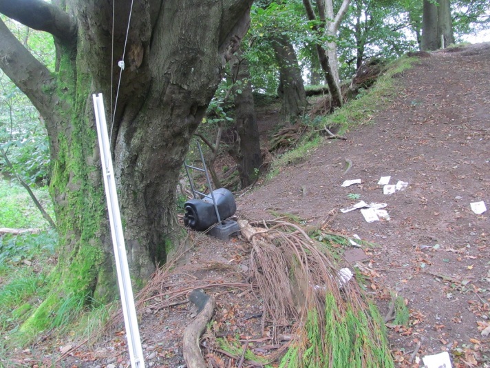
Pathways lead to the Haer Stane through trees, creating a buffer from the urban surrounds and generating a ‘peaceful’ ambiance albeit one punctured by the neighbouring school currently being a building site. Huddled in a corner was a boulder (presumably found during building works), acting as a weird megalithic table surrounded by four plastic school chairs. I wonder if this was a survivor of the kerb that once defined the pond around the Haer Stane?

Megalithic table low res

The Haer Stane came into view, a spectacular brute of a boulder, set in the centre of a circle of trees, paths and park benches. Neighbouring house windows overlooked the complex, while dog walkers patrolled at all times. I spoke to one local guy with a dog who told me that the location had become problematic with youths coming into the memorial park drinking (hence the sign at the entranceway) and he also complained about the omission of certain names from the new placque on the Stane itself, some kind of local grumble that I could make little sense of.

Haer Stane view from north low res

Haer Stane low res

Up close, the monument was more complex than I had imagined it could have been. The juxtaposed granite cross seemed to grow from the erratic beneath it, and the two stones displayed no discernible harmony with one another. The Haer Stane itself seems to have cracked in the past, with these cracks evident and filled with some kind of stone-glue. Perhaps this damage was done converting this into a war memorial, cracking it open to insert the cross-stone, enforcing this new role and identity onto the boulder against its will.

Megalith glue low res
Megalith glue.

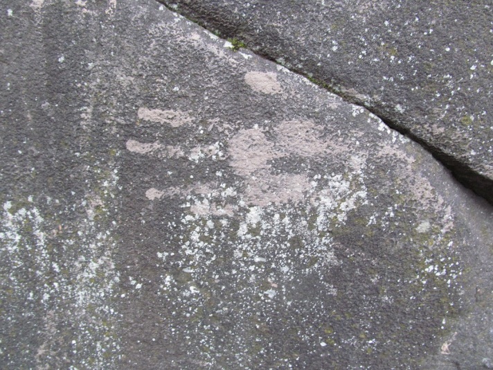
The boulder was also coated in a thin mud-slip in places, and a few mud ball splats. It was possible to identify child-sized soil handprints around the belly of the stone. The haptic qualities of this monument has clearly been explored by local youths with dirty exuberance.

Stains on the Stane.

Handprint 1 low res

Hand print 2 low res

A green metal placque on a small stone at the base of the monument (the one that had in the past been on the edge of the pond) displayed the following information.

1921

To the memory of

the 27 men who gave their

lives for us in

The Great War 1914-1919

This memorial was raised by their

relatives and friends in

Tullibody Cambus District

Placque low res

Attached to the Haer Stane itself are two black stone squares with names carved into them; these were appended to the stone in 2013 replacing an earlier version (as reported in the local newspaper).

War memorial 626 squadron
(c) Alloa Advertiser

These too had been smeared with mud.

Black placques low res

The re-purposing of this ancient glacial boulder – by definition prehistoric in the broadest sense of this word – into a war memorial fits in well with the hybrid traditions identified by Williams. Here we have a mixture of the ancient, the early medieval and the twentieth century, shaped into an immovable and timeless focus for commemoration. But it also fits well with another tradition, that of archaeological monuments that find themselves in urban settings. The biography of this site since it emerged from the mists of time has been erratic, unpredictable, at times marked by acts of folly. It is now part of the urban landscape, surrounded by the trappings of such places, and despite increased maintenance and watchfulness from the local community, I doubt if it has reached its final form.

One thing that does seem to be a consistant aspect of this monument is the recurring and locally maintained story that the Haer Stane had prehistoric monumental origins. The local Heritage Centre webpage for instance prominently states:

Tullibody – One of the oldest villages in Scotland. We now know that the first peoples were living in this very area. Tullibody looked very different in those days as it was a peninsula, surrounded by water. The early people worshipped the sun and it is now known that Tullibody War Memorial stone formed part of a Druid Circle.

This is also the story given on war memorial websites such as this one where the site is explicitly called the Druid Stone.

Screen grab from war memorial web page

There seems to be a desire to attribute to this monument something more than just random glacial activity, I would imagine because an origin in the deep-time of human (pre)history fits better with the narratives of memorial and myth-building that mourners, descendants and the local community need this place to be. The  truth of it will probably never be known nor does it matter.

Solace has been sought in deep Anthropocene time.


Sources and acknowledgements: The Howard Williams paper to which this blog post is heavily indebted has the following citation: Williams, H 2014 Antiquity at the National Arboretum. International Journal of Heritage Studies 20.4., 393-414. To get information about Tullibody’s past, I made use of a few really good local sources of information and images, and these are all cited as sources of the old postcards in the post above. Most of this post was written on a train, hence its untidiness.

Melancholia

Some urban prehistory sites are strange. Some are sad. Some are both.

There is something melancholy about a prehistoric site that has been destroyed with nothing done to compensate. We are now used to the fairly cosy arrangement that we can accept the destruction of archaeological sites in exchange for them being professionally and fully excavated. This is a deal that archaeologists – and society without most being aware of it – have made with the free market economy. We won’t interfere too much with endless development, change and economic progress and the juggernaut won’t completely flatten what is left of the past without first slowing down a bit or taking little detours. The result is jobs in the heritage sector, lots of random data we would otherwise not have, and sometimes local communities benefit from these transactions too. This might be a Faustian pact, it might even be entirely sensible, but it does mean that in 2017 one of the most important and uncontrollable ways we have of finding prehistoric sites and sucking the information out of them is driven by social need for, and the political demands of, development.

But in the nineteenth century when society was still getting to grips with the implications of massive scale urban and industrial expansion, railway line and canal building, and the requirement for the extraction of the necessary aggregates to make these things happen, no such deal existed. Archaeological sites were swept aside simply because they were literally the wrong place at the wrong time. And so inconvenient standing stones were  toppled, or ”blown with powder’ as in the case of a stone circle at St Colmac’s, Bute. To add insult to injury, whatever survived these extractions was then put to use as building materials, built into walls and barns, or broken up and utilized serendipitously and randomly e.g. in road and rail foundations. Stone cists and coffins were emptied of their contents, with much of the goodies inside ending up on the mantelpieces of the rich landowner, local vicar or an eccentric antiquarian, soon to be ‘lost’. Of course, this was all underpinned by money as well – but the power relationship was balanced differently than it is now. Archaeological sites could be swept away on a whim, facilitated by the signing of a cheque (one of those big fancy Victorian ones), and the data and information that resulted from any crude interventions that followed could be characterized as limited, selective and often rubbish.

Whoever said that no deal was better than a bad deal?

A dead megalithic monument in Clackmannanshire prompted these thoughts to be re-articulated once again. It is a sad and strange story that represent the ways that even substantial prehistoric monuments, when competing with the demands of nineteenth century economic requirements and the requirements of the landed gentry could come to a very sticky end, reduced to nothing more than an antiquity map symbol.


I have a Cunninghar plan

The site to which I refer was called Cunninghar in Tillicoultry. This is a monument that according to varied accounts was substantial, consisting of a circular or oval setting between 20m and 35m in diameter of standing stones three feet high at the foot of the Ochils. (A bank apparently surrounded this, suggesting to me this was a kerb cairn rather than a stone circle for what it is worth.) No record of the number of stones survives, nor any etchings or drawings of this monument. The enthusiastic recorder of prehistoric lost causes and megalithic wild goose chases, Fred Coles, tried to get to the bottom of the story of this stone circle right at the end of the nineteenth century, his sources of information patched together from conversations with an experienced local forester, an OS Name Book entry and some nifty mapwork.

His informant, the estate forester, gave a vivid description of the stone circle and the fate that it met (for the source of this quote, see the end of this post; Location A is shown on Cole’s map reproduced below):

McClaren statement from Coles 1899

The rather undignified evisceration and re-purposing of the monument by the local gentry for their own grand designs, and also perhaps with one eye on the quarrying and thus financial potential of this location to come, left the bank and one single standing stone on site, which became the focus of excavations in the 1890s when two cists, one containing a fine Food Vessel, were discovered on site as the ridge was gradually denuded for aggregate extraction. The account of these discoveries was documented fastidiously by R Robertson in a paper written slightly before Coles arrived on the scene, and in his observation that the site was situated on an ‘elevated ridge of sand intermixed with gravel’ lies the seeds its downfall at the hands of quarrying for those materials.

There is no need to rehearse the details here of the discoveries that occurred in harmony with the rhythm of the extension of the gravel quarry, surprising extractions, suffice it to say that several Bronze Age pots, and a stone marked with rock-art, were discovered.

Food Vessel from Tillicoultry Robertson paper

Rock-art photo Robertson paper

My favourite detail of these impromptu rescue excavations was the discovery by Robertson in the location within a cist that one would have expected a head to be located, ‘a quantity of a fibrous or hairy substance, of dark-red colour’. Analysis was undertaken of this mysterious material by a Professor Struthers who appears to have been something of an expert in these matters, having his own collection of ancient hairs which he sometimes exhibited to the public. He concluded, by comparison with his own reference collection, that this was not the hair of a man, ox or horse – but it might have been the ‘wool’ of a fox, dog or rabbit. (Audrey Henshall later suggested it was otter.) No further analysis of this was undertaken but I like to imagine this was the remnants of a crazy stoat hat. (It is worth noting also that the name of this site derives from something to do with rabbits suggesting this is the kind of location where a rabbit might have burrowed into a cist by accident and died in there. Just saying.)

Cist plan Tillicoultry Coles paper

Fred Coles reported on another cist found here a few years later, although had nothing to say on the matter of the ginger-haired deposit. He also noted that quarrying had not begun at the south end of this ridge by the time of the OS 1st edition mapping of the 1860s, but by then, the stone circle was already gone, for the reasons already noted above. The sand pit to the north suggests the landowner was well aware of the potential value of this location and the pesky stone circle that was on the way of his bank account being further bloated.

OS 1866
OS 1866

Later maps show the outline of the quarrying in more detail, and so show the activities that led to the discovery of Bronze Age burials here as well as completely removing the site where the stone circle / kerb cairn. In a sense the quarrying was more destructive than the standing stone removal, in the same way as extracting one’s teeth is not half as bad as losing your mouth.

This megalith was wiped off the map, and it was on maps that ironically was the only place where it continued to exist.

OS 1866
OS 1951

Gradually, this location became increasingly surrounded by housing estates and the trappings of the modern urban landscape. Using a really helpful map that Coles made of the archaeological discoveries at Cunninghar, and subsequent mapping, it is possible to roughly plot where these key discoveries were made in relation to the modern Tillicoultry – sandwiched between Dollar Road and Sandy Knowe with a fine view over a cemetery and war memorial.

Location map

It was no surprise to me when I visited on a quiet Saturday morning that there is no sense whatsoever that in this corner of Tillicoultry once stood a substantial multi-phase Bronze Age monument. The Cunninghar sand and gravel ridge that so attracted quarriers survives within the urban setting, in the form of a wide grass-covered bank that runs north-south between two housing estates. A path runs along this ridge and I mounted it, from my parking position on the appropriately named Sandy Knowe, via a set of steps. Once on the embankment I followed a rough path that lead to a broader and uneven overgrown area with a mast atop it. This metallic tower stood within a steel cage with warning signs adorning it.

The mast

Grassy knoll

The skull

Tree symbol

This area betrays little to nothing of its former purpose, other than that it is possible to imagine this as a prominent viewing point with views down to the River Devon. The ridge came to a sudden end at a wall on the fringe the A91, while an escarpment topped with a feeble fence which meandered from east – west marked the limit of the sand and gravel quarry that was once here that finally removed the remnants of this monument, the conclusion of a slow-motion series of interventions.

The quarry

As I wandered around in the faint hope of seeing something, anything, that might hint at megaliths, burials or an embankment, I noticed a large stone lying on the other side of the fence on the edge of what was once the quarry. This had previously been identified by the Northern Antiquarian as being a remnant from the stone circle, and although it seemed to me too small to have fulfilled this purpose, it did look out of place and may once have been a prehistoric something or other.

Remnant

Down I went into the quarry, now an overgrown edgeland betwixt road, mound and back gardens, nothing but weeds and rubbish strewn about. Spatially, if not physically, there had been a stone circle here once, perhaps elevated 5m above my head. But all that remained were random sad objects: a twisted child’s car seat, a hoard of charity shop sacks and the splayed and stretched out tendons of a Venetian blind.

Remnants

This made me melancholy. A stone circle had been lost – so be it. But it had been lost and not adequately compensated for. A Food Vessel, Urn and a clump of dead rabbit / otter had been added to the archaeological record, dots on a distribution map (except for the rabbit unless there is a distribution map of Bronze Age wigs), but we don’t even know how many megaliths once stood here. Tillicoultry House with its amazing standing stone lined drain was demolished around 1960, another victim of progress, while the current location of the rock-art-marked stone, visited and visible to Ronald Morris in 1966, is unknown. The Food Vessel is held in the collections of the National Museum of Scotland.

Tillicoultry House
Tillicoultry House. Drain not visible. Source: http://www.ochils.org.uk

There is nothing to let people whose houses are literally metres from where a prehistoric centre of ritual, ceremony and burial once stood know about this, no noticeboards that might inform casual passers-by, a lack of an app or virtual reality ancient version of this place to download. This monument has gone, a victim of all sorts of Victorian hoo-ha. And not only was the monument destroyed, but the place where this monument once stood was destroyed, atomically removed. Once it was removed, the megalith was split up into pieces and then it was later destroyed again, a second death. The burials that were left behind were recovered to an extent, but are now hopelessly dispersed.

There was no deal here – this was a hard extraction, and once the stones had fallen from this cliff edge there was no going back.

I have often said in the past that urban prehistory is not about a sense of loss, or sadness, and this is still the case. But for Cunninghar there have only been bad outcomes, as bad as it gets, and it seems a hopeless case, all that remains being this sad story and footnote in the National Monuments Record of Scotland.

Melancholy is not the same thing as sadness, nor is regret. What I regret about some urban prehistoric sites is that their destruction was in vain, the price paid too high.

Prehistorica melancholia.


Sources and acknowledgements: This post benefited from many conversations with Helen Green about heritage, development and compensatory measures (or lack thereof). 

Little has been published on Cunninghar, or the variants of spelling of that name that are out there (Cuninghar, Cunningar). Two articles were published in close succession in the Proceedings of the Society of Antiquaries of Scotland about this site, both referred to above. The first of these was Robertson’s 1895 effort, ‘Notice of the discovery of a stone cist and urns at the Cuninghar, Tillicoultry’, in volume 29; the second Cole’s 1899 ‘Notices of the discovery of a cist and urns at Juniper Green, and of a cist at the Cunninghar, Tillicoultry, and of some undescribed cup- marked stones’ (volume 33). Both can be read online for free via the Society webpage. The image of the Food Vessel came from the Robertson paper, the cist plan and rock-art ‘photo’ from Coles, and the latter also provided the quote near the start of the post.