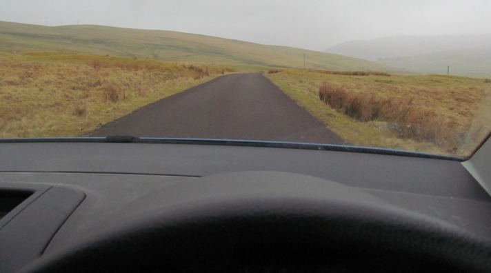
Last month I drove through a henge. Right through the middle of it. On a little road. The location was remote. It was cold, a bit wet and low mist hung over the surrounding hills. The henge was barely discernible. Invisible to the ‘untrained eye’. Yet there it was, a low broad bank, a weed-filled damp ditch, with a raised platform in the interior. And a road right through the middle of it. A little road, one that does not even appear to have a number. A dead end. A road that leads nowhere really, just up to a reservoir with lots of warning signs not to enter and not to park, and a house with a crazy tree house. But that isn’t relevant.

The drive thru henge is called Normangill (NMRS number NS92SE 11) in South Lanarkshire, near Crawford. It is located in the valley of the River Camp with low rolling hills on all sides, some adorned with wind turbines. The henge is class 2, that is, it has two opposed entrances, in this case on the north and south sides of the enclosure. It is quite a large monument, up to 60m in diameter on its longest axis, defined by a flat bank and shallow wide ditch. The entrances on the north and south sides are both very wide, at least 17m. As with many henges, the boundaries and entrances are disproportionately large relative to the size of the monument as a whole, and so it actually encloses a relatively small area. And a road.


The monument is bisected by this little east-west running road, which cuts a swathe some 10.7m wide right through the middle of this ancient enclosure. Curiously, this little road seems to have started life as a railway line. OS mapping from the 1920s shows this feature to be a railway, branching off the nearby main Glasgow – Carlisle line at Crawford, but really it was only a little railway line.

A little railway line that appears to have serviced a prisoner of war camp at the end of the valley. This was in use in the First World War and there German prisoners were engaged in building the dam that holds back Camps Reservoir that now lies at the end of the little road which bisects the henge. This is one of only 39 such camps in Scotland associated with the Great War, and like most such camps, almost nothing is known about it and barely any traces survive (it has NMRS number NS92SE 66).

The process of driving railway tracks through the henge caused a schism in the monument. The bisection of the henge has an almost exactly east-west orientation, while the henge itself is orientated north-south. The henge is now divided into four quadrants: NE, NW, SE, SW. Other effects were also created by railway and road construction. This cutting produced spoil which seems to have been piled into the centre of the henge itself, mis-shaping the monument. It has a peculiar mounded appearance, with the bank visible in section on both sides of the road, albeit grassed over. Only a trowel scrape from being exposed. And at least the road has rendered the henge accessible to those with cars or via an easy flat walk from Crawford a few miles away. Having said that I am not sure how many people actually know that the henge is there, or how many visitors it receives.
Many will drive thru, but how many stop? The little road is a quiet road and the henge is largely silent.
Roy Loveday has observed the recurring spatial proximity of Roman roads and Class 2 henges in the north of England, and this is not a crazy a thought as it first seems. Clearly the Romans were interested in existing routeways (which henges often sat within) but also local sacred and ancient sites which they often took a colonial interest in. Some Roman roads not only lie close to class 2 henges, but run parallel to them, suggesting a certain flow through the landscape was maintained. A Roman road passes close to Normangill too. In other words, henges were usually built in places that were moved through, by roads, tracks and rivers, and often reflect those routes. But not many henges have been subverted to become routes themselves as is the case at Normangill.
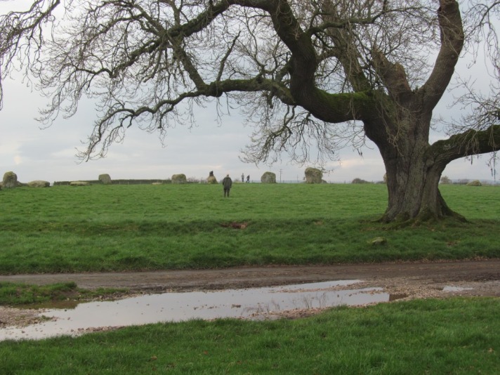
It is possible of course to drive into and through the massive henge at Avebury in Wiltshire (as well as have a pint in the middle of the henge, a luxury not afforded to visitors to Normangill). And you can also drive through Long Meg and Her Daughters stone circle in Cumbria; indeed you can park within the stone circle, although you then have to perform an awkward turning manoeuvre on the road, or within a nearby farm yard. I have seen a milk tanker do it so it can be done.

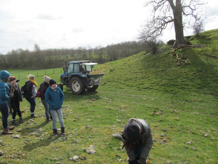
And if you have a tractor, you can pretty much drive through any henge you want, such as this character I spotted whizzing around within Mayburgh Rings henge recently, dispensing little white balls from a chute at the back of his farmyard machine.

‘Drive thru’ is a label of convenience in the world today. Drive thru fast food. Drive thru coffee shops. Drive thru weddings and funerals. Drive thru this, that and the other. It seems that some do not even want to have to get out of their cars to furnish themselves with fast food and hot drinks, or take part in some life-changing ceremonies. I was once told (in a previous job with a government agency) that in the past OS archaeological fieldworkers would only record sites that they could see from their landrovers, so Normangill must have been very popular back then. Flasks, cameras and notepads all that were needed to update the archaeological record.

I suppose the collision of car and henge, two distinctly different things belonging to very different cultures, is indicative of many of the weird contemporary engagements that we have with prehistoric sites. Even in this ‘rural’ location, the industrial, urban, mechanical intrudes. Cars crash through this henge and for those in the know, a secret pleasure can be derived by these seconds of fusion, curiously Ballardian, but over all too soon.
Sources and acknowledgements: I drove thru / through Normangill henge with Helen Green, whom I must thank for helping formulate my thoughts for this post and who told me about the site in the first place. The limited amount of information there is out there on this monument largely comes from CANMORE and the air photo used in this post is an amended version of the RCAHMS copyright image LA2950CN – I am not sure when the photo was taken, probably in the 1970s or 1980s. The map extract is from an OS One Inch Map (series produced 1921-1930), which can be viewed online via the National Map Library of Scotland – this map is out of copyright. Information on prisoner of war camps came from Gordon Barclay’s very interesting 2013 report ‘The Built Heritage of the First World War in Scotland’. Roy Loveday’s paper ‘Double entrance henges – routes to the past’ can be found in an edited volume called Prehistoric ritual and religion (edited by Gibson and Simpson, published by Sutton, 1998); like most things written by Roy, it is well worth a read.


Great thought provoking post!
enjoyed that discovery shared,another example is the road at Clava Cairns near Inverness which seperates 2 stones from the Western cairn.Shown in one of my airviews.
Very interesting, thanks. Here’s a kite aerial photo of Normangill Henge from Hamish F
http://www.megalithic.co.uk/modules.php?op=modload&name=a312&file=index&do=showpic&pid=70975
Thanks Andy, and sorry for taking so long to reply. These are amazing images, much clearer than the rather distant RCAHMS air photos.
An interesting article – thanks. A Roman road – ‘High Dyke’/Ermine Street – cuts directly through a recently excavated henge at Navenby in Lincolnshire. Nothing to see on the ground, but I often take a detour from the A607 so I can drive through it.
Thanks Terry, and sorry for taking so long to reply. The Romans often built their roads near or over ‘native’ sites (as Roman archaeologists often call them). And I hope it gives you a thrill to know you may be the only person who is actually aware you are driving through a henge!